Annapolis Park Historic District
Historic Photo from NRHP Filing
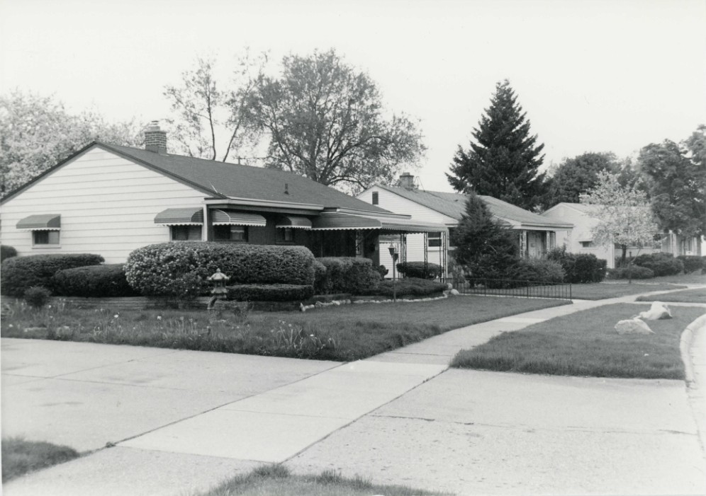
Annapolis Park Historic District — Street address: 4710 Julius Blvd, 1956, National Register of Historic Places filing, Detroit
National Register of Historic Places Filing
Julius Schwartz and his partners developed Annapolis Park as an African American suburban neighborhood in the mid-1950s. A neighborhood of modern ranch houses -most with brick exteriors - located along winding streets, Annapolis Park was platted in three sections between September 1953 and January 1955. The 354-lot neighborhood was described in June 1954 at the time of the development's formal dedication as 'the largest housing project built for minority groups in the Detroit area in many years.' When local banks proved reluctant to provide sufficient mortgages to meet the demand, Schwartz and his brother-in-law, Jack Kellman, established their own mortgage company. Largely through word of mouth, it appears, Annapolis Park became an instant success, with 134 houses built during 1953 and 54, 168 more during 1955, and the remaining fifty-one houses built in 1956 and 57.
Annapolis Park possesses exceptional historical significance among the vast amount of suburban residential developments around Detroit's edges built in the early post World War II era as a neighborhood of well-built modern housing intended from the first for African Americans. With many homes still occupied by descendants of the early residents, it remains an attractive, well-kept neighborhood today.
Physical Description
The Annapolis Park Historic District is a roughly L-shaped residential neighborhood of ranch houses, most with brick exteriors, platted in three stages and developed in the 1953-57 period. Named presumably in reference to Annapolis Road, which passes by the neighborhood's north edge, Annapolis Park contains 354 houses sited along a series of curvilinear streets. Annapolis Park is bounded on the east by the four-lane Middlebelt Road and touches on Van Born Road on the south, Annapolis Road on the north, and Henry Ruff Road on the west. All of these are important local traffic arteries, Middlebelt and Van Born being four-lane structures.
Much of the surrounding land was farmland when Annapolis Park was developed, and substantial open land still exists nearby despite fifty years of suburban development. Thomas, the street just north of Annapolis Park's north end on the north side of Annapolis Road, contains brick houses similar to Annapolis Park's, and additional housing of similar and later age stands along Annapolis' north side to the west. A recent neighborhood of single-family homes stands along Van Born Road's north side south and west of Annapolis Park, with a large complex of manufactured homes at the northwest corner of Van Born and Henry Ruff farther to the west. Churches that serve the neighborhood stand along Annapolis Road's south side- Our Saviour's Lutheran, with The Village of Our Saviour Senior Living Community complex to its immediate west, at the Middlebelt/Annapolis intersection, People's Community Baptist, located west of the houses on Julius' west side, St.
James United Methodist to its west, and the Annapolis Park Church of Christ farther west, at the southeast corner of Henry Ruff- and another church, Beulah Baptist, is located on Middlebelt's east side just north of Van Born. All these are large modern buildings.
NRHP Ref# 06000405 • Data from National Park Service • Content available under CC BY-SA 4.0
Historic Photos
(13)Sourced from the National Register of Historic Places filing
Annapolis Park Historic District—Annapolis Park Historic District — Street address: 4710 Julius Blvd, 1956, National Register of Historic Places filing, Detroit
Public Domain (Michigan Filing)
Building Details
- Year Built
- 1956
- Building Type
- Historic District
- National Register
- Listed 2006
- Ref# 06000405