Antietam Street/Grand Trunk Railroad
Also known as: Antietam Street Bridge
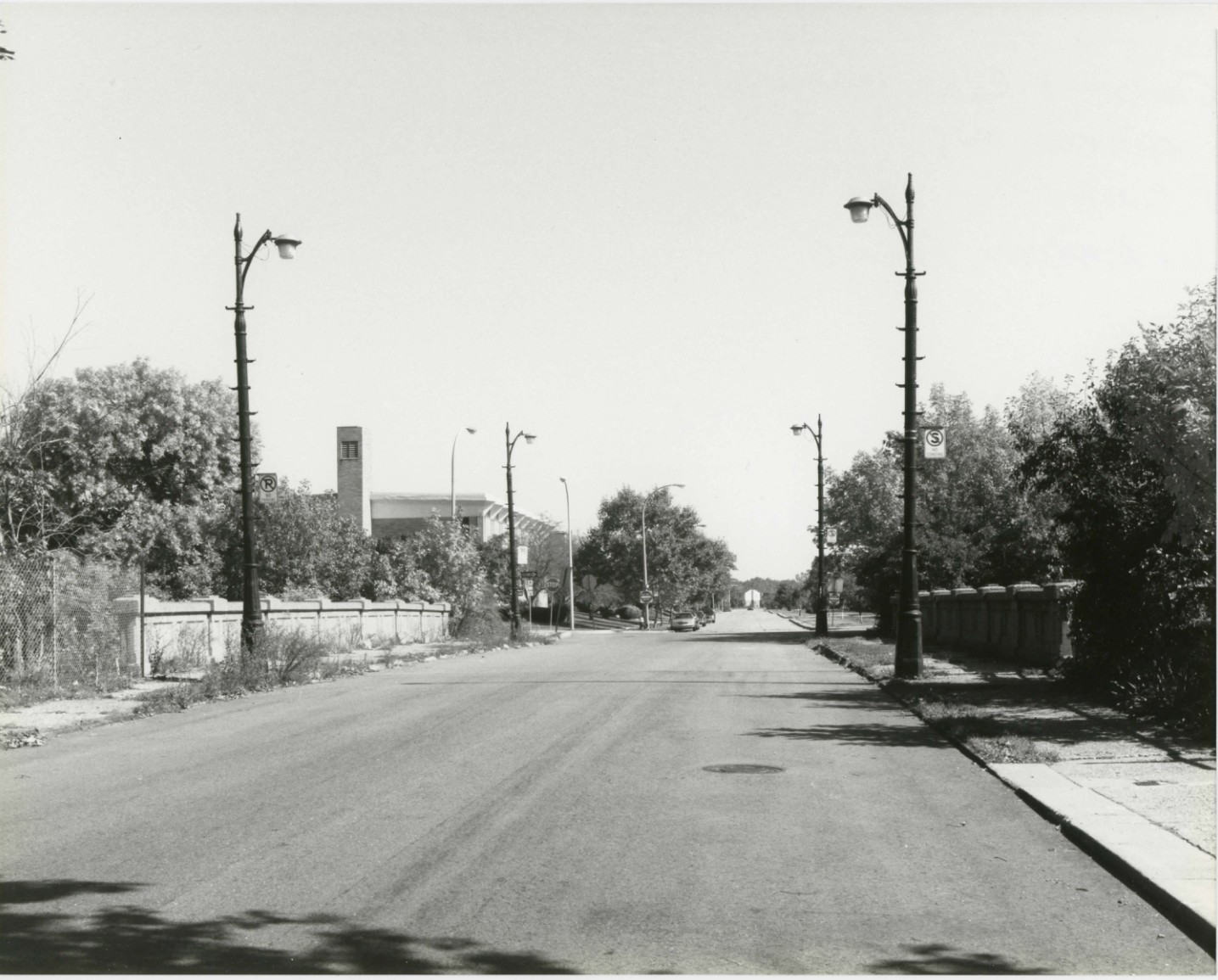
Historic Photo from NRHP Filing
Antietam Street/Grand Trunk Railroad — historic photograph, 1930 Grand Trunk Railroad, National Register of Historic Places filing, Detroit
National Register of Historic Places Filing
The Antietam Street Bridge is eligible for the National Register under Criterion A as a well-preserved representation of urban grade separations built during a formative period of highway development. In the first decades of the twentieth century, Detroit experienced substantial industrial growth. By the 1920s, there were over 400 industrial firms operating between Woodward Avenue, which bisects downtown Detroit, and the city's north (Belt Line) and east (Detroit River) boundaries. The city's rather haphazard street plan, the result of incremental platting, impeded traffic flow, particularly on east-west routes.
Traffic jams were compounded by the expansion of factories, which sometimes required street closures, and by the network of railroad tracks essential for transporting raw materials and finished goods. In January 1923, in an attempt to improve the situation, the city and the Grand Trunk Railroad launched a ten-year program to build 22 grade separations. Each party paid part of the construction cost. By 1926, Detroit's grade separation program was 'fulfilling the expectations of its sponsors,' according to John W.
Reid of the city's Department of Public Works, an early advocate of grade separations. By March 1930, sixteen of the crossings were finished. The bridge at Antietam Street was completed soon thereafter. The Antietam Street Bridge was teamed as a one-way pair with the Chestnut Street Bridge in 1964, when St.
Aubin Boulevard was reconstructed. The Chestnut Street Bridge has also been nominated to the National Register. The Grand Trunk Railroad tracks that once ran beneath this bridge extended northwest to connect with a network of other lines. To the southeast, near the shore of the Detroit River, the tracks turned to parallel the river and serve the substantial factories that developed in this area in the late nineteenth and early twentieth centuries, including the Detroit-Michigan Stove Plant (6000 East Jefferson), the United States Rubber Company Plant (6600 East Jefferson), and the Parke-Davis Laboratories (1 McDougall Avenue).
The railroad tracks also continued along the river to the southwest, terminating at the Grand Trunk's Brush Street Depot in downtown Detroit. The depot and most of the industrial plants have been demolished. One pair of the tracks that ran in the corridor below the Antietam Street and Chestnut Street Bridges has been removed. The corridor and the bridges, however, retain good integrity.
The integrity of some of the other bridges over the corridor, such as M-3 (Gratiot Avenue), has been compromised by modern alterations. The course of the corridor and its relationship to the city's street system is less apparent at other bridges, such as those carrying Division and Adelaide Streets. The Antietam Street and Chestnut Street Bridges, therefore, are good representative examples of a significant grade separation effort initiated in response to Detroit's explosive industrial and population growth in the first decades of the twentieth century.
Physical Description
The Antietam Street Bridge is a 88-foot, three-span, steel-stringer structure with a maximum span of 41 feet. The stringers are concrete encased and carry a 30-foot-wide roadway on a 50.3-foot-wide concrete deck covered with asphalt. Each solid concrete parapet railing of the slightly skewed structure has three recessed panels -- two rectangles and a square -- between eight concrete posts. Luminaires are situated at each end of the sidewalk, on the roadway side.
The design of the four fixtures features a cylindrical wood pole supported by a metal base. The original metal arms of the luminaires carry newer globes. A metal manhole cover just beyond the northwest end of the bridge is stamped 'Public Lighting Commission 1930.' The bridge is supported by concrete abutments and two piers, which consist of five metal posts on a single concrete base. The posts are braced at the top by arched metal struts.
Architect/Builder
Designer: Grand Trunk Railroad
NRHP Ref# 00000114 • Data from National Park Service • Content available under CC BY-SA 4.0
Historic Photos
(2)Sourced from the National Register of Historic Places filing
Antietam Street/Grand Trunk Railroad—Antietam Street/Grand Trunk Railroad — historic photograph, 1930 Grand Trunk Railroad, National Register of Historic Places filing, Detroit
Public Domain (Michigan Filing)
Building Details
- Architect
- Grand Trunk Railroad
- Year Built
- 1930 — Demolished 2008
- Building Type
- bridge
- National Register
- Listed 2000
- Ref# 00000114
