Clinton-Kalamazoo Canal
Historic Photo from NRHP Filing
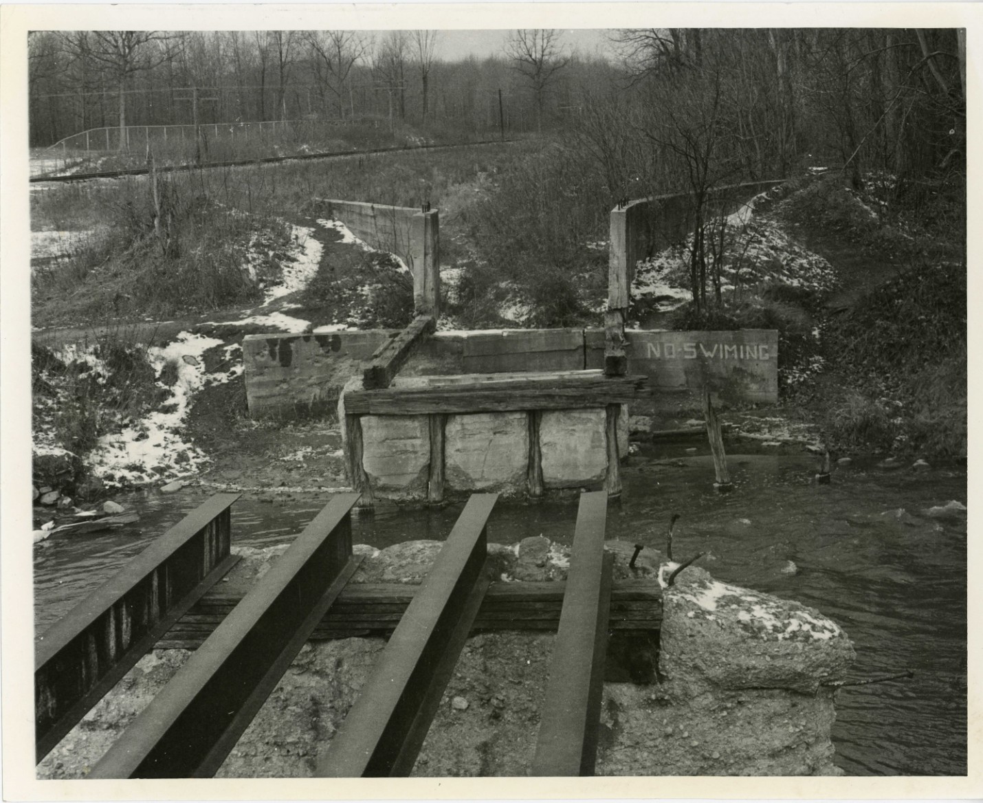
Clinton-Kalamazoo Canal — A view of a dam or water control structure with a sign reading 'No Swimming, National Register of Historic Places filing, Runs between Utica and Yates, Yates, Detroit
National Register of Historic Places Filing
Article XII of the Michigan Constitution (1835) encouraged the legislature to inaugurate a program of internal improvements for the state. The legislature was to ascertain 'the proper objects of improvement in relation to roads, canals, and navigable waters' and to provide for the necessary funds. The session of the 1837 legislature proceeded with the scheme of railroads and canals. There were strong arguments in favor of the program.
Other states had greatly succeeded with their improvement enterprises (for example, New York and Ohio). Internal improvements would bring population to Michigan, thus increasing the value of the land. Products of industry would have prompt and economical transport. On March 20, 1837, the legislature enacted the Internal Improvements Bill.
It authorized surveys to be made of three railroads across the Lower Peninsula. Two canals were also to be surveyed, one connecting the Clinton - Kalamazoo rivers, the other joining the waters of the Saginaw and Grand rivers.
Physical Description
The object of the Clinton - Kalamazoo Canal was to connect Lake St. Clair and Lake Michigan, a distance of approximately 216 miles. The canal was to begin at Mt. Clemens, on the Clinton River, and continue across the Lower Peninsula through Macomb, Oakland, Livingston, Ingham, Eaton, Barry, and Allegan counties terminating at the mouth of the Kalamazoo River.
The summit level, as surveyed, commencing at Pontiac and extending approximately 42 miles is 344.61 feet above the surface of Lake St. Clair and 336.11 feet above Lake Michigan. Lake Michigan is 8 feet above Lake St. Clair.
The amount of lockage on the eastern declivity was determined to be 349.61 feet and on the western declivity 341.11 feet. The six longest levels are (in whole numbers) 42 miles, 28 miles, 27 miles, 18 miles, 17 miles, and 12 miles. The requisite amount of water to supply the canal for its entire length is 27.313 cubic feet per minute. The surface and soil on the surveyed line of this work was reported more than ordinarily favorable to the construction of a canal.
The first link of the canal was to join with the Clinton River east of Rochester. The canal continued westward from Frederick to Utica through muck, marsh, and sand. This area was also dense with forests. The canal ran northwest from Utica to Rochester.
This section needed to be raised 100 feet in order to overcome the summits of rising surface levels. This was accomplished by building a series of locks and dams. The locks were of standard-gauge and constructed of heavy timber. At Yates Crossing an aqueduct was constructed of heavy timber to carry the canal over the top of the Clinton River at right angles.
Work ceased at this point due to lack of funds. The disgruntled workers destroyed much of the canal they had built. Poor workmanship and the action of wind, rain, water from the river, spring freshets, and cave-ins further degenerated the canal. The starting point of the canal at Frederick can no longer be seen.
However, a section of the canal can be seen as it bisects the Hillcrest Country Club, west of Mt. Clemens. The original 20-foot wide canal has been narrowed and made shallow by encroaching vegetation and washed-earth. At Utica, sections of the canal have been filled in.
The foundation piers and approaches of the old aqueduct at Yates Crossing are still standing. The wood superstructure has deteriorated and collapsed into the river. The canal continues from Yates Crossing to Bloomer State Park No. 2, where it ends at a dam. The waters of the canal have been polluted by sewage and rubbish.
The nominated property extends from Hall Road, south of to the aqueduct at Yates Crossing on Dequindre Road, and includes property fifty yards on either side of the canal.
NRHP Ref# 72000638 • Data from National Park Service • Content available under CC BY-SA 4.0
Historic Photos
(2)Sourced from the National Register of Historic Places filing
Clinton-Kalamazoo Canal—Clinton-Kalamazoo Canal — A view of a dam or water control structure with a sign reading 'No Swimming, National Register of Historic Places filing, Runs between Utica and Yates, Yates, Detroit
Public Domain (Michigan filing for National Register of Historic Places)
Building Details
- Address
- Runs between Utica and Yates, Yates
- National Register
- Listed 1972
- Ref# 72000638