Parke Lane Road/Thorofare Canal Bridge
Historic Photo from NRHP Filing
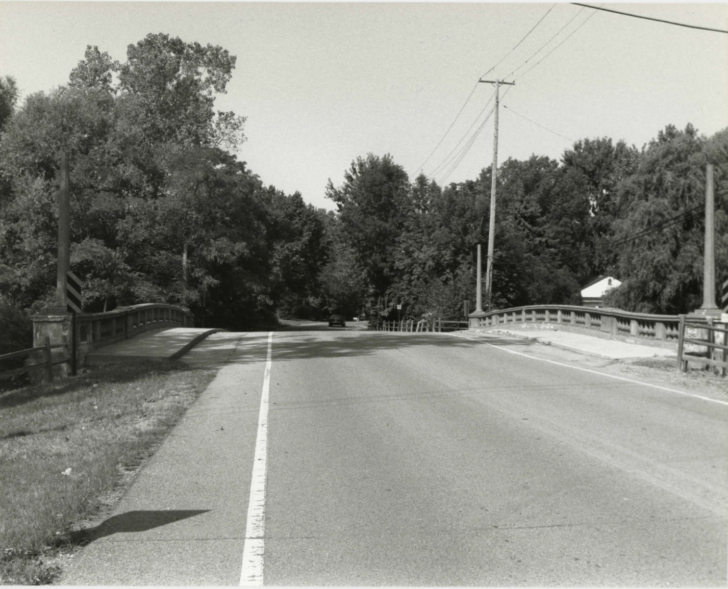
Parke Lane Road/Thorofare Canal Bridge — historic photograph, 1929 Gosner and Flynn, Designer: Wayne County Road Commission Cantilevered concrete arch, National Register of Historic Places filing, Parke Lane Road over the Thorofare Canal, Grosse Ile, Michigan, Detroit
National Register of Historic Places Filing
As a noteworthy example of aesthetically pleasing design, and as an interesting representative of concrete cantilevered-arch construction, the Parke Lane Road Bridge is eligible for the National Register under Criterion C. As an outstanding product of the Wayne County Road Commission's bridge engineers, the bridge also qualifies under Criterion A. Grosse Ile's written history began in 1679, when it was described by missionary and explorer Father Hennepin. It gained a railroad in 1873, when the Chicago and Canadian Southern Railroad completed a bridge from the Michigan mainland, lying across the Trenton Channel to the west; the link to Canada was by ferry.
Although the island was surveyed in 1808, it did not become a separate township until 1914, when it split from Monguagon Township. A writer in 1922 observed: 'Grosse Ile is famed as an island of beautiful homes and large estates, many of which are occupied by descendents of the old families associated with the early history of the island.' It also housed a naval base and airport by the 1920s. In the late nineteenth or early twentieth century, the township erected a hand-operated swing bridge to carry Park Road (now Parke Lane Road) over the Thorofare Canal, which crosses the northern half of the island on a northeast-southwest diagonal. By 1929, this narrow, lightweight structure was obsolete due to increases in traffic volume and vehicle weight.
In addition, the piles supporting the bridge were rapidly deteriorating. The old structure was replaced by an exceptionally attractive concrete cantilevered-arch span. The county road commission's 1928-1929 annual report observed that 'the beautiful lines of the arch of this bridge surmounted by its ornamental handrail and cluster lighting is in keeping with the surroundings.' County road commission plates on the northwest and southeast railing ends identify the bridge as 'Job No. 328,' built in 1929. Plates on the southwest and northeast ends identify it as a state reward bridge, and give a construction date of 1930.
The state highway department included a photograph of the completed structure in its 1929-1930 biennial report.
Physical Description
Grosse Ile is the largest island in the Detroit River, located near its mouth at Lake Erie. The area between Grosse Ile and downtown Detroit, about 20 miles to the northeast, experienced intense industrial development in the early twentieth century, but the island evolved as an exclusive residential area. Substantial nineteenth- and twentieth-century houses on large lots surround the Parke Lane Road Bridge, a concrete cantilevered arch. The properties to the east are on the shore of the Detroit River.
The bridge's graceful arch, which includes an 18-foot cantilevered section, is complemented by concrete balustrade railings with urn-shaped spindles. Orange pebble aggregate adds color and texture to the spindles, and to octagonal lamp standards on each end of the railing. The lamp globes are missing. The 51-foot span carries a 36-foot-wide roadway on a 51.5-foot-wide deck.
The total length of the bridge is 99 feet. Concrete abutments and slightly curved wing walls support the structure. The bridge retains excellent integrity.
Architect/Builder
Contractor/Builder: Gosner and Flynn, Designer: Wayne County Road Commission
NRHP Ref# 00000043 • Data from National Park Service • Content available under CC BY-SA 4.0
Historic Photos
(1)Sourced from the National Register of Historic Places filing
Parke Lane Road/Thorofare Canal Bridge—Parke Lane Road/Thorofare Canal Bridge — historic photograph, 1929 Gosner and Flynn, Designer: Wayne County Road Commission Cantilevered concrete arch, National Register of Historic Places filing, Parke Lane Road over the Thorofare Canal, Grosse Ile, Michigan, Detroit
Public Domain (Michigan Filing)
Building Details
- Architect
- Gosner and Flynn, Designer: Wayne County Road Commission
- Year Built
- 1929
- Address
- Parke Lane Road over the Thorofare Canal, Grosse Ile, Michigan
- Building Type
- Bridge
- National Register
- Listed 2000
- Ref# 00000043