Pleasant Ridge Historic District
Historic Photo from NRHP Filing
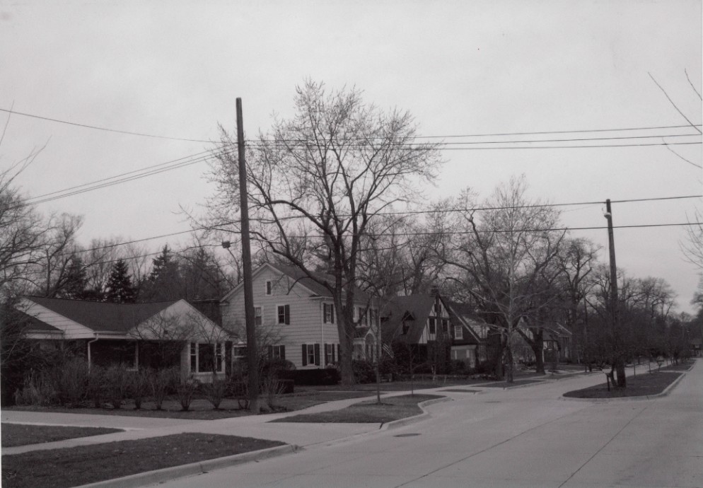
Pleasant Ridge Historic District — historic photograph, National Register of Historic Places filing, Roughly bounded by Willington Rd., Woodward Ave., Ferndale and Ridge Rd., Pleasant Ridge, Detroit
National Register of Historic Places Filing
Physical Description
The Pleasant Ridge Historic District Boundary Increase is a westward extension of the Pleasant Ridge Historic District, listed in the NRHP in 1996. The proposed addition is rectangular in size, 88.9 acres (0.14 square mile) in extent, and contains 340 residences and the associated property. The single family homes present a cross-section of architectural styles popular during the first half of the twentieth century, most commonly variants of Colonial Revival and English Cottage as well as Arts & Crafts and Bungalow. The district presents a remarkably intact and cohesive assemblage of homes and well preserved streetscapes.
It is similar in character to the Pleasant Ridge Historic District located in adjacent blocks to the east. Pleasant Ridge, Michigan's smallest incorporated municipality in land area, is a residential suburb of Detroit, largely developed in the early twentieth century like the neighboring cities of Ferndale that adjoins it on the south toward nearby Detroit and Royal Oak to the north. Woodward Avenue, which runs in a southeast-northwest alignment from downtown Detroit out to Pontiac, bisects the community, with commercial frontage along much of its length and mainly early twentieth-century residential development behind extending in both directions from the corridor. The existing Pleasant Ridge Historic District is located west of Woodward Avenue, extending from Woodward Avenue itself or just back of the commercial frontage west to include the properties on the west side of Ridge Road, and from I-696/10 Mile Road on the north south to the north Ferndale boundary.
The boundary increase or extension area extends from the west edge of the existing district to the west Pleasant Ridge boundary and between I-696 on the north south to the Ferndale boundary. The existing district and the extension area encompass the entirety of Pleasant Ridge west of Woodward Avenue. In its street plan of primarily east-west streets that intersect Ridge Road, an early highway built along a one-time beach ridge from the last glacial era, the extension area relates closely to the existing district. Two of the east-west streets, Elm Park Avenue and Cambridge Heights Boulevard, extend west from Woodward all the way to Oakdale Boulevard.
At the same time the only north-south roads in the existing district and the extension area are Ridge and two streets at the extension area's far west end, Oakdale Boulevard and Maplefield Road. Along with their plans the existing district and extension area also share a physical isolation from adjoining neighborhoods and communities. An undulating tall red brick wall along the north edge of the district and extension physically separates these areas from I-696/10 Mile Road. Of the north-south streets, only Ridge Road continues both north and south of the district and, within the extension area, only Maplefield provides a connection with adjoining neighborhoods, and it only on the south with Ferndale.
No streets run west from Maplefield to connect with adjoining neighborhoods in Oak Park. The existing district and the extension area form one cohesive neighborhood standing in splendid isolation from their surroundings. While the Ferndale neighborhood directly south of the district and extension displays a similar character (that becomes less upscale within a few blocks to the south), the adjacent section of Oak Park to the west differs greatly from Pleasant Ridge in its character, with smaller houses that, except for one block of brick ranches, appear to reflect more piecemeal development over time. Both the existing district and extension area are lush in their profusion of old trees, largely maple and oak, and large shrubs that shade the streets and ornament yards.
In both areas the streets are narrow, but in both the existing district and extension area several of the streets are boulevards with grassy medians. In the extension area Woodside Park Boulevard, Kenberton Drive, and Oakdale Boulevard display such grassy medians. The district is entirely residential in composition. The houses in the extension area are generally similar in size and architectural character to the homes in the existing district except for the part of the existing district on Ridge Road's west side where the homes and their large lots are estate-like.
The oldest houses in this portion of the city post-date the earliest houses on Ridge Road in the Pleasant Ridge National Register district to the east, but the vast majority (nearly 75%) were built during the same period as those in the existing historic district, between 1920 and 1950. The residences are generally one or two stories in height. Colonials, English Cottages, and bungalows and Arts-and-Crafts-influenced houses predominate. Many of the residences occupy lots of 50 to 75-foot frontage with consistent setbacks that foster a dense residential character.
The narrower lots generally occur in the western and southern portions of the extension area, with wider lots generally more common in the northern and eastern blocks. The wider lots, commonly 80 feet in width, characterize much of Woodside Park Boulevard, Kenberton Drive, and Elm Park Avenue, and contain some of the more imposing homes in the neighborhood, generally English Cottage or Colonial in inspiration. The narrower lots, 40-feet in width, most commonly occur in the southern portion of the extension area along sections of Hanover Avenue and Norwich Road, and on Woodward Park Boulevard at its north edge. These are occupied by some of the extension area's more modest houses, generally small bungalows.
Despite a variation in lot size, most houses are enframed in mature street trees, generally at least one centered on the lot directly in front of each residence, and are further enhanced by individually landscaped yards. The houses together present a consistent streetscape of well-kept homes. Architectural variation across the extension area reflects variables as basic as different lot sizes. Larger lot sizes along Kenberton Drive and Elm Park Avenue in the northern portion of the extension area and along portions of the south side of Cambridge Heights Boulevard at the south edge are reflected in generally larger residences on these lots than in the rest of the district.
The Colonial Revival is particularly common along Cambridge Heights and Elm Park, while Kenberton reveals a greater variety of styles, with Arts & Crafts and English Cottage rivaling Colonial in popularity, similar to Woodside Park that parallels Kenberton at the north limits of the district. The district's smallest lots in blocks commonly built upon prior to World War II occur along Hanover, Norwich and Oakdale, generally comprising the central section of the district. Hanover favors Colonial Revival although English Cottages are also prominent in numbers, while Norwich displays a range of styles, Colonial most popular followed by English Cottage, with Arts & Crafts and French Eclectic also popular. A similar variety is displayed along Oakdale, which contains some of the best examples of English Cottage and Craftsman Bungalow.
The number of Bungalows constructed along this street is the highest in the district. Maplefield, although platted early, was not fully occupied until after a post-World War II replat, and this is reflected in the housing constructed along it - although Colonials are the most common, the number of Contemporary and Ranch houses is the highest of any street in the district.
NRHP Ref# 10001024 • Data from National Park Service • Content available under CC BY-SA 4.0
Historic Photos
(8)Sourced from the National Register of Historic Places filing
Pleasant Ridge Historic District—Pleasant Ridge Historic District — historic photograph, National Register of Historic Places filing, Roughly bounded by Willington Rd., Woodward Ave., Ferndale and Ridge Rd., Pleasant Ridge, Detroit
Public Domain (Michigan Filing)
Building Details
- Address
- Roughly bounded by Willington Rd., Woodward Ave., Ferndale and Ridge Rd., Pleasant Ridge
- National Register
- Listed 2010
- Ref# 10001024